This article reviews top commercial drone mapping software that could help farmers and agricultural businesses better understand the crop data they’re collecting.
Using advanced multispectral drone mapping software allows the user to get strategic insights on farm health that aid the practice of precision agriculture.
Ultimately, this will help put more money in the pockets of farmers by maximizing crop yields and helping in the farm optimization process.
Importance of Multispectral Crop Health Auditing
- Proactive Pest & Disease Management – Monitoring multispectral crop data provides an opportunity to spot crop diseases even before they manifest symptoms to the naked eye.
- Fertilizer Geolocation – Crop health auditing eliminates guesswork within the fertilizer application process and reduces fertilizer waste by ensuring that nutrients are applied only where and when required.
- Better Water Management – With consistent monitoring, the subtle differences in cells occupied by water can be measured, and irrigation can be optimized.
- Cost Savings – With multispectral crop health auditing, precise crop treatment is applied, and resources are no longer wasted managing the crop.
- Improved Profitability – Monitoring crop health is enhanced, resulting in an increased yield and a more profitable crop.
- Improved Management – Monitoring multispectral crop data provides field-based crop management recommendations that are data-based and actionable.
Key Poinst & Best Commercial Drone Mapping Softwares for Multispectral Crop Health Auditing
| Software | Explanation |
|---|---|
| Pix4Dfields | Analyzes multispectral imagery, delivers crop health insights and maps. |
| DroneDeploy | Creates accurate field maps, monitoring crop stress and variability. |
| Agisoft Metashape | Processes aerial imagery into detailed multispectral crop health models. |
| PrecisionHawk DataMapper | Generates actionable agricultural insights from multispectral drone-collected datasets. |
| DJI Terra | Converts drone data into maps supporting precision agriculture decisions. |
| Sentera FieldAgent | Identifies crop issues early using advanced multispectral analytics tools. |
| MicaSense Atlas | Cloud-based platform analyzing vegetation indices for healthier crop management. |
| Trimble Inpho | Produces geospatial crop maps with precise multispectral data processing. |
| SimActive Correlator3D | Delivers high-speed mapping and crop monitoring from drone imagery. |
| Propeller Aero | Simplifies aerial data processing for efficient crop health assessments. |
10 Best Commercial Drone Mapping Softwares for Multispectral Crop Health Auditing
1. Pix4Dfields
Pix4DFields has created one of the most sophisticated multispectral drone mapping products designed specifically for agriculture.
The software can create maps of NDVI and NDRE indices, which allows farmers to see field stress before it manifests physically.
Additionally, the software has fast field processing which allows the agronomists to create prescription maps for variable rate applications.
The software is compatible with most of the major agricultural drones and sensors. Pix4DFields helps farmers optimize yield and help decrease the cost of farming by providing crop management data during the entire growth season.
Pix4Dfields Pros & Cons
Pros
- Tailored specifically for workflows in precision agriculture.
- Processes multispectral drone imagery rapidly.
- Generates prescription mapping for variable-rate application.
- Compatible with most agricultural drone sensors.
Cons
- Very high pricing for commercial users.
- Lacks most features for advanced GIS.
- Demands a lot of processing power.
- Difficult for first-time users.
2. DroneDeploy
DroneDeploy has arguably the best software for agricultural drone mapping. The software has one of the most sophisticated and user-friendly systems on the market.
The software processes multispectral data and creates accurate maps of the field and the variations in crops, irrigation, and nutrients.
The automated processing and recent AI enhancements save farmers time and help with crop monitoring by quickly identifying anomalies. This sets the framework for a sustainable farming approach while maximizing productivity.
DroneDeploy Pros & Cons
Pros
- Particularly ‘user-friendly’.
- Flight & automated drone operations planning features.
- Developed & driven via cloud technology.
- Excellent features for team share & collaboration.
- Highly advanced, automated AI-driven crop analysis.
Cons
- Subscription plans can be costly.
- Reliant on the internet for product access.
- Very advanced features are locked under a paid plan.
- Very large data sets drastically increase processing costs.
3. Agisoft Metashape
Agisoft Metashape is a powerful tool for developing detailed multispectral crop health models utilizing drone imagery. It produces orthomosaics, digital elevation models, and vegetation analysis maps.
Its large dataset management can be combined with multispectral analysis to provide answers to crop performance in varying field conditions.
It is extremely versatile and has a lot of room for customization and is highly recommended to agricultural researchers and specialists in precision farming.
Agisoft Metashape Pros & Cons
Pros
- Multispectral data sets & advanced analysis no boundary.
- Very advanced 3D modeling.
- Excellent & highly accurate results in photogrammetry.
- Lots of customization.
Cons
- Complex interface.
- Photogrammetry & modeling highly intensive.
- Very limited agriculturally centered reporting & analysis.
- Steeper learning curve.
4. PrecisionHawk DataMapper
PrecisionHawk DataMapper is a multispectral analysis tool geared towards drone developers with the intent to deepen agricultural understanding from the data provided.
Its imagery aids in the assessment of field performance and the surveillance of plant health and diseases outbreaks during the growing season.
Its advanced algorithms dive deeper into vegetative patterns, especially those that pertain to lagging growth and other issues. Through the integration of analytical processes and atmospheric data, a clearer understanding of crop health is created.
PrecisionHawk DataMapper Pros & Cons
Pros
- Very advanced analytics & data processing.
- Great crop health insights & analysis.
- Excellent data fusion & integration.
- Very large scale operations analysis.
Cons
- High price for small farms.
- Some features require specialized training.
- Spotty availability.
- Enterprise/large-scale design & setups take considerable time.
5. DJI Terra
DJI Terra is drone mapping software that falls perfectly within the DJI ecosystem. Easy mapping and modeling of drone-captured imagery into 2D maps and 3D models used for precision agriculture is a breeze.

Post-analysis of crop health and management of field resources is vastly improved by the stress detection and multispectral processing functionalities of the software. A highly recommended precision farming software due to its ease of use and reliability.
DJI Terra Pros & Cons
Pros
- Works great with DJI drones.
- Fast processing and easy mapping.
- Great beginner workflow.
- Supports 2D and 3D mapping.
Cons
- Performs best inside DJI’s ecosystem
- Lacks advanced analytics
- Windows only
6. Sentera FieldAgent
Sentera FieldAgent focuses on crop intelligence and multispectral analysis. The platform helps users identify issues with plant health ahead of time, often before even the most trained eye can spot them in the field.
By analyzing specific metrics, the platform even helps users identify pests, nutrient deficits, and irrigation issues. The reports generated by Sentera help simplify the process of targeting an intervention.
This method is less costly and, in the long run, helps improve yields by eliminating previous efforts to target a problem with chemical interventions.
Sentera FieldAgent Pros & Cons
Pros
- Great crop stress detection
- Fully agricultural analytics
- Field reports
- Helps identify problems early
Cons
- Not much use outside agriculture
- Premium-priced features
- Small ecosystem
- Non-compatibility sensors limit value
7. MicaSense Atlas
The MicaSense Atlas platform is designed to maximize the value of multispectral drone images in the agricultural setting.
The platform automatically generates vegetation index maps and trends on the performance of crops in a variety of settings.
When paired with MicaSense sensors, Atlas provides one of the most optimal solutions on the market for determining the health of crops.
The platform even provides comparisons to analyze and assess the development of a crop over a specified time.
The platform has an intuitive design that makes the assessment of the development of a crop simple and helps quickly implement changes to improve crop health.
MicaSense Atlas Pros & Cons
Pros
- Great vegetation indices
- Cloud-based
- Easy integration with MicaSense
- Comparisons with past crops
Cons
- MicaSense hardware needed for best results
- Can get pricey with subscriptions
- Limited offline use
- Hard to use outside agriculture
8. Trimble Inpho
Trimble Inpho is an advanced tool for surveys needing exceptional detail and accuracy for measurements within the multispectral region.
Its photogrammetry design, with sophisticated algorithms for processing and mapping vegetation, orthomosaics, and terrain of varying complexity, is invaluable to crop health analysis, the variability of fields, and the management of resources.
This is one of the preferred software suites of commercial farming for its efficacy within programs offered in the realm of precision agriculture.
Trimble Inpho Pros & Cons
Pros
- Great for enterprise-level mapping
- Can process massive data sets
- Great for advanced geospatial processing
- Great for professional surveying
Cons
- Pricey
- Complex for beginners
- Takes a lot of computing power
- Too much for small farms
9. SimActive Correlator3D
Processing rapidity is valued by large agricultural operations and their drone imagery capture. SimActive Correlator3D is sufficiently rapid, processing multispectral data quickly into maps, models, and assessments.
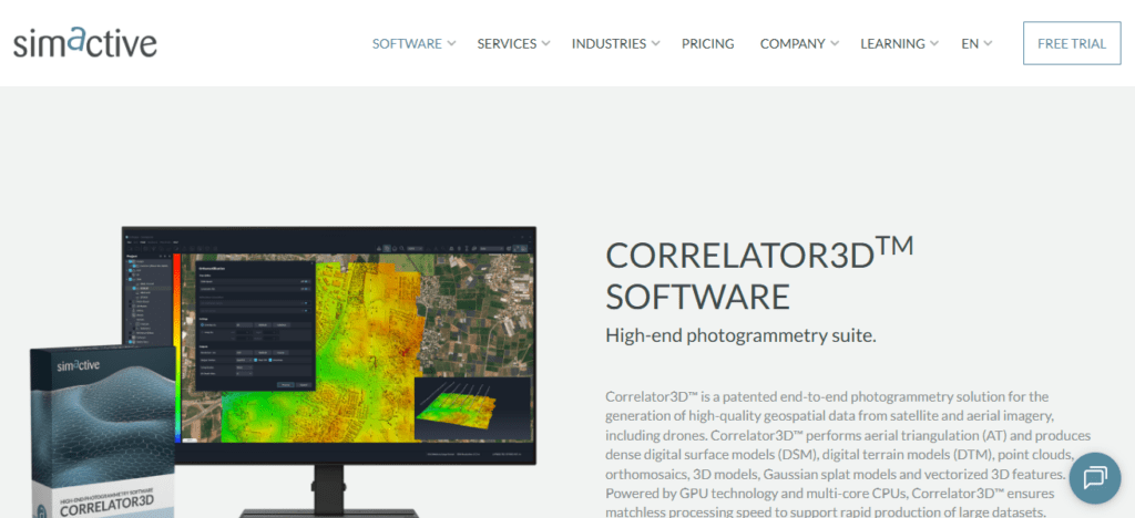
Its automation optimally balances processing time and quality. Farmers and agribusinesses can analyze the output to study crop progress,
stress variations, and the efficacy of fields. Its efficacy is a reason Correlator3D is preferred by large commercial operations.
SimActive Correlator3D Pros & Cons
Pros
- Fast image processing
- Great maps
- Large drone operations
- Advanced automation
Cons
- Pricey
- Not beginner-friendly
- Needs high specs
- A few agricultural features
10. Propeller Aero
Propeller Aero has crafted a pragmatic and efficient workflow for agricultural mapping and processing drone data. Its platform converts multispectral imagery from drones into insights for farmers to assess crop status and manage field operations.
Propeller simplifies the process for farm operations using advanced, cloud-based workflows. Unlike other mapping applications
Propeller’s dashboards distill the health of crop foliage and display the areas of lowest performance in an intuitive manner, thereby establishing a ranked order of field tasks.
Propeller Aero is the logical choice for commercial farming operations that require timely assessments of crop health.
Propeller Aero Pros & Cons
Pros
- Easy Cloud software
- Great management of drone data
- Fast processing and visualization
Cons
- The subscription costs can be considerable.
- You need an adequate internet connection for cloud processing.
- There are limited advanced controls for photogrammetry.
- Some competitors have more customization capabilities.
Choosing The Appropriate Software for Drone Mapping
Multiple Sensor Compatibility Review the software’s ability to integrate with your drone and multispectral camera.
Consider Processing Speed Farms with larger physical areas require software that can manage and process large amounts of data.
Assess Vegetation Indexes Multi-index support such as NDVI, NDRE, and SAVI is especially beneficial.
Analyze Scalability Select the software that is most likely to support your future growth as an organization.
Analyze Reporting Features Advanced reporting features drive better and more proactive decision-making.
Advanced Crop Monitoring Allows for the identification of stress factors and issues well before they impact the potential yield.
Reduced Input Costs Leads to better and more responsible use of fertilizer, pesticides, and irrigation.
Conclusion
In conclusion, the ideal commercial drone mapping software for conducting multispectral crop health scans includes programs that enable farmers to undertake aerial surveys and provide them with precise recommendations regarding their farming practices.
Programs like Pix4Dfields, DroneDeploy, Agisoft Metashape, and DJI Terra come with various analytic and mapping features, and offer tools for crop surveying.
The software that best meets your needs is a function of the dimensions and budget of your farm, but will assist with maximizing your return on investment and rationalizing your farming activities.
FAQ
Pix4Dfields, DroneDeploy, and DJI Terra are among the most popular options for precision agriculture and crop health monitoring.
NDVI (Normalized Difference Vegetation Index) measures plant health by analyzing how vegetation reflects near-infrared and visible light.
Yes. Advanced multispectral analysis can identify disease symptoms and crop stress before visible signs appear.
Cloud-based solutions offer easier collaboration and scalability, while desktop software often provides more control and offline processing capabilities.